
History and culture
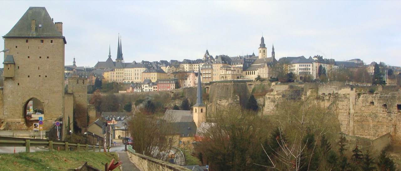
Bock connects the city’s early history with Siegfried’s acquisition of the rock in 963. Later fortifications and underground galleries belong to other periods: the casemates should not all be dated to the tenth century. The old quarters and fortifications have been a World Heritage property since 1994, not the entire country. The palace grew from a town hall, and the cathedral from a Jesuit church later enlarged. Neimënster changed between monastic, prison and military uses; its modern cultural centre opened in 2004. The early-twentieth-century Adolphe Bridge helps explain the transition from the fortified core to the opposite side of the valley.
Walking here means comparing levels: institutions in the upper town and reused historic buildings in the valley. Do not treat every institution as a freely open museum: the palace has separate visiting arrangements, the cathedral serves worship and Neimënster follows a cultural programme. Local food can begin with pork and broad beans, green-bean soup, flour dumplings and potato cakes; check the recipe, availability and ingredients with the actual kitchen.
Keep entrances to working institutions clear and follow security instructions. In the cathedral, respect worship and other visitors and photograph interiors only under the current rules. Interior photography and video recording are prohibited in the palace. Ask consent for portraits; exhibitions and concerts can have separate restrictions. Give way on narrow paths, do not cross fortification barriers for a view, and do not occupy cycle or tram lanes.
Places
Grand Ducal Palace
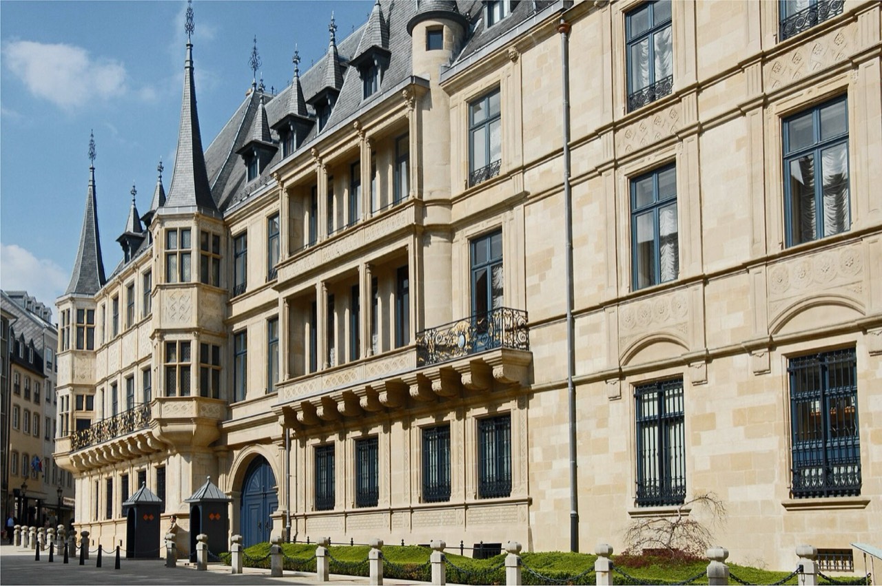
A working official building with a decorative façade on rue du Marché-aux-Herbes.
The complex grew from a sixteenth-century town hall and was expanded later. The adjoining Chamber building dates to 1860; the ensemble is not all from one period.
Compare the detailed façade with the more restrained parliamentary architecture from the permitted public side.
The regular summer 2026 tours ended on 30 August. The Chamber separately announced a joint opening on 17 October: an exception with security and limited capacity; recheck the announcement before travelling. The walk covers the façade, not guaranteed interior entry. Photography and video are prohibited inside the palace.
Notre-Dame Cathedral
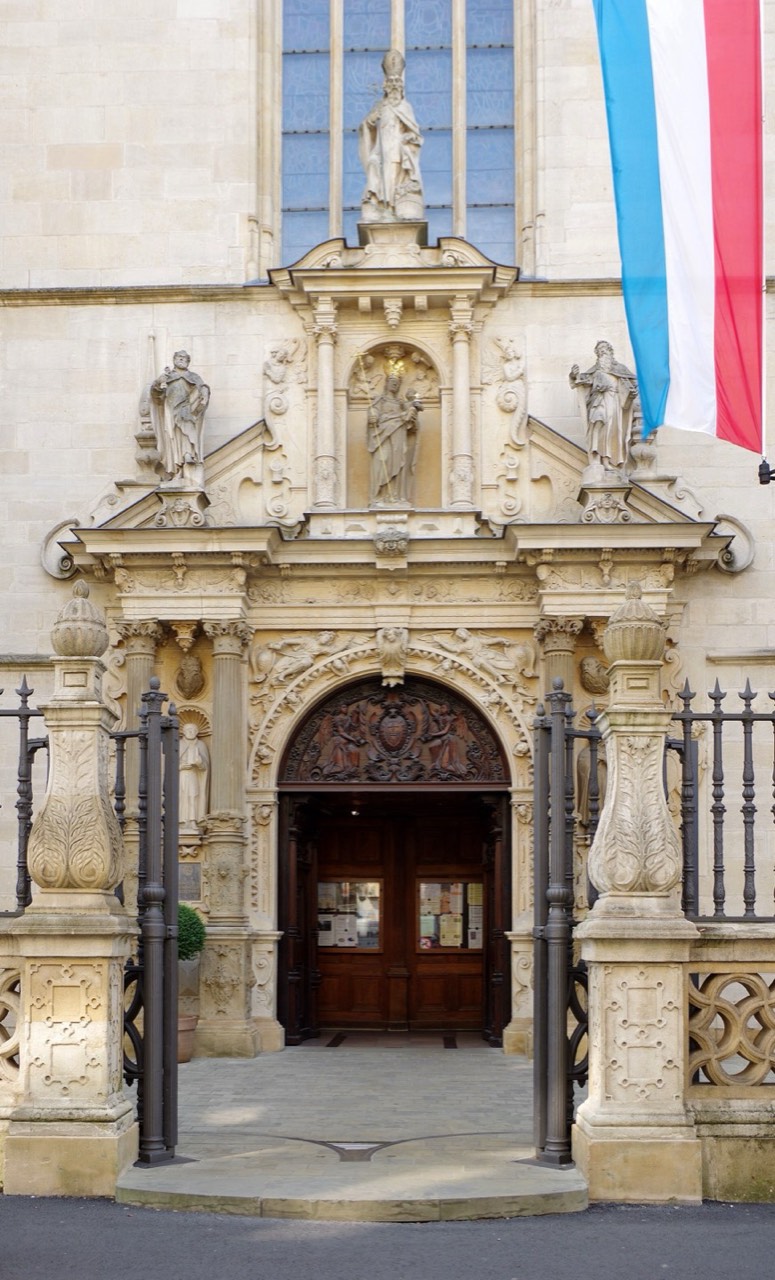
An active Catholic cathedral near the upper-town institutional centre.
Construction of the Jesuit church began in 1613. It became a cathedral in 1870; the 1935–1938 enlargement means the current building is not entirely seventeenth-century.
Observe how different building periods form one working church; attending worship and architectural sightseeing are different purposes.
The exterior stop does not depend on crypt or audio-guide access. Check church entry against services and photography rules, and keep aisles clear. The rue Notre-Dame approach does not guarantee access to every interior space. For images, check depicted-part rights, particularly the later enlargement.
Bock Promontory and Casemates
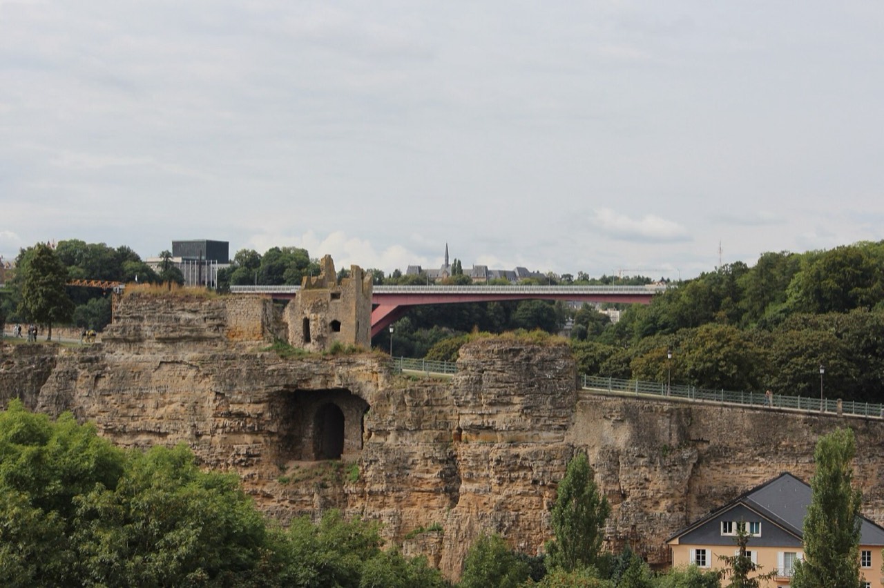
The rocky edge of the old town and a separate ticketed underground attraction.
Siegfried acquired the rock in 963; the underground defences belong to later periods, including eighteenth-century Austrian works. The old quarters and fortifications entered the UNESCO list in 1994.
Outside, study the rock’s relationship to the valley; inside, explore the defences if entry is permitted and suitable for your needs.
The point marks the casemates; the walk starts at the exterior approach, not underground. Check tickets, entry slots and accessibility with LCTO before buying: the underground site is not presented as step-free. Official closures include 25 December and 1 January. Do not use a closed stairway or tunnel as a shortcut.
Chemin de la Corniche
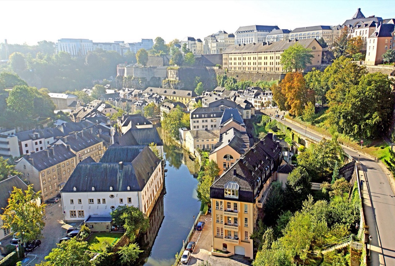
A section of the promenade by old fortifications overlooking Grund and the Alzette.
The promenade follows fortifications extended by Spanish and French builders in the seventeenth century. Paths and terrain changed after fortress dismantling; it is not an unchanged medieval track.
Compare Neimënster’s exterior from above and below. The map point represents one section, not the entire Corniche.
Approaches contain changes in height, steps and shared streets. Stay on the path side of barriers rather than sitting on wall edges. Slow down in rain. A short panoramic stop does not mean the entire route is stair-free or suitable for every wheelchair.
Adolphe Bridge
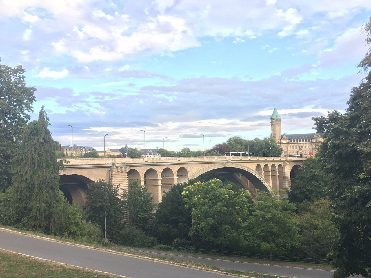
A stone arch bridge above the Pétrusse valley, connecting two areas of urban development.
The bridge was built in 1900–1903. Its large twin-arch span was a notable engineering achievement of its time, not a claim to a current world record.
From the upper pavement, compare the valley with the dense upper-town development. Understanding the structure does not require descending to paths below.
The map point represents the structure; our route uses the upper pavement, not the nearest two-dimensional point in the valley. Use marked crossings rather than tram tracks. The lower suspended walkway is not included in this walk. Check current restrictions and do not stop in a traffic lane.
Neimënster
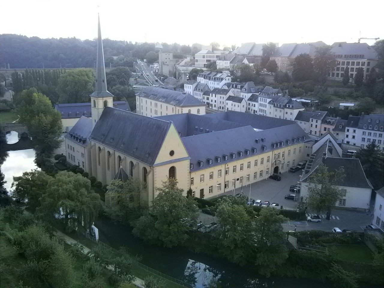
A former monastic complex, now a cultural venue in the Grund valley.
The monastery on this site was founded in 1606; destruction in 1684 and subsequent rebuilding mean not all buildings are original. Later uses included prison and military hospital. The cultural centre opened in 2004; the disappeared 1083 Altmünster was a different complex.
From the exterior square, observe historic buildings reused for contemporary culture. The adjoining church and the whole centre are not one object.
The point represents Parvis de l’Abbaye, the complex’s exterior approach, not a particular church altar. Check the programme, square access, tickets and interior-room hours; a free exhibition does not make every concert free. Our stepped walking approach is not presented as accessible.
Walking routes
Palace, Cathedral and Upper Bridge
From the palace exterior, follow rue du Rost and rue de l’Eau to rue Notre-Dame and the permitted cathedral approach. Continue along public pedestrian sections and pavements of rue Notre-Dame, the marked crossing by the valley and the upper Adolphe Bridge pavement. Verified connected sections are about 227 and 510 m; the stated 1000 m allows for approaches and stops. The endpoint is the bridge’s upper level, not a Pétrusse trail below or the lower suspended deck. Do not cross tram tracks away from a permitted crossing or use interiors as through routes. The 145-minute estimate includes three exterior stops, not a palace tour, queue or full return journey. Kerbs and current restrictions need checking; this route is not certified wholly step-free.
1 km · 145 min
- Grand Ducal Palace · 30 min at stop
- Notre-Dame Cathedral · 30 min at stop
- Adolphe Bridge · 25 min at stop
Exterior Bock and Corniche
Start at the open exterior approach by the Bock entrance, not the underground casemates map point. Follow permitted outside paths towards Montée de Clausen, then use pavements and Château Bridge, continuing along the public Corniche line to the marked section near rue Large. The connected chain is about 436 m; 700 m allows for approaches and orientation. The chosen approach includes 9 steps and later 29 steps at a descent, so this is not step-free. Closed Bock stairway way 1287196543 and tunnel way 71194928 are NOT used. Stay on pavements along road sections and do not cut corners across walls. The 100-minute estimate covers two exterior stops; ticketed casemates, queues and the full return journey are additional. For a closure, return by a safe open route.
0.7 km · 100 min
- Bock Promontory and Casemates · 35 min at stop
- Chemin de la Corniche · 30 min at stop
Corniche to Neimënster
From the marked Corniche section, follow rue Large, the permitted stone path and stairway towards rue Sosthène Weis. Use the street’s right pavement, then public descents to the Stierchen footbridge; beyond it, stairs lead towards Neimënster’s exterior square. The connected chain is about 471 m; the stated 800 m allows for permitted approaches. Mapped sections contain 5, 18, 5 and 24 steps, including a metal stairway without a ramp; some stone passages are unlit. This is not step-free and does not ford the Alzette. Go in daylight, do not enter closed gates and reserve energy for the separate return ascent. The 110-minute estimate includes two exterior stops, descent and pauses, not a concert, interiors or the full return journey.
0.8 km · 110 min
- Chemin de la Corniche · 25 min at stop
- Neimënster · 35 min at stop
Food
Judd mat Gaardebounen
Smoked pork collar with broad beans and potatoes is a traditional Luxembourg choice. These are broad beans, not the green beans of Bouneschlupp. Serving style and sauce quantity depend on the kitchen.
Check the sauce for dairy, mustard and possible wheat-based thickening. Pork makes this non-vegetarian; the name is not a halal assurance. Ask about a smaller portion before ordering rather than estimating smoked-meat salt from a photograph.
Bouneschlupp
Green-bean soup with potatoes; classic versions contain smoked bacon and a creamy component. Vegetable stock in a recipe does not itself remove meat from the rest of the dish.
Ask about bacon or sausage, cream, butter and flour thickening. For allergies, check milk and wheat, including bread separately. A vegetarian version needs confirmed ingredients, not merely the word “bean”.
Kniddelen
Flour dumplings, not potato gnocchi. A local recipe uses milk and eggs, with bacon serving a separate meat variation. Sauce and sides can differ.
Check wheat, eggs, milk, butter and meat accompaniments. Removing bacon does not make the dough vegan or gluten-free. Ask about sauce and shared cooking fat; a tourist-board recipe does not establish every restaurant portion’s composition.
Gromperekichelcher
Crisp potato cakes with onion and herbs. A published local version uses eggs and flour or starch; apple purée can be an accompaniment, not a compulsory filling.
Potatoes do not guarantee absence of wheat or eggs. Check binders, oil, shared frying and dairy additions; a starch version does not establish absence of cross-contact. At a fair, verify availability and price separately without assuming year-round sales.
Wäinzoossiss with Mustard Sauce
Pan-fried local sausages with mustard sauce and often mashed potatoes. Descriptions disagree about wine inside the sausage; the checked sauce recipe includes white wine, cream and veal stock. Do not assume identical composition for every product.
Check meat, mustard, dairy, thickening and wine. Heating does not guarantee zero alcohol, and a wine-free sausage does not rule wine out of the sauce. Confirm mash and side ingredients: beans with bacon remain a meat accompaniment.
Practical information
Within Luxembourg, public buses, trams and second-class trains are free, including for tourists; first class and the international part of a journey have separate fares. Since 2 March 2025, line 1 has connected Findel / Luxembourg Airport with Stadion via Hamilius and Gare Centrale. Check Mobiliteit before travelling: free transport does not promise a 24-hour service, no engineering works or free taxis. The upper town, Grund and bridges lie on different levels: the nearest point on a map may be below a bridge. Use pavements and marked crossings, not tram tracks. For an accessible alternative, check operational lifts, approaches and venue entry separately; our walks containing stairs do not substitute for that itinerary.
Protect belongings on buses, at Gare de Luxembourg and in busy places; do not leave phones and documents on tables, and be cautious about sharing bank details with strangers. Wet stone and steps on descents to Grund require gripping footwear; a bridge point may be above the valley rather than on its trail. Stay on permitted paths, allow energy for the return ascent and stop for closures or unsafe weather. For taxis, check an official rank, the tariff and possible supplements. An offline pack does not certify current access or provide phone coverage.
Euros and Payments
The currency is the euro, EUR, not the Luxembourg franc. Ask about card acceptance and any minimum at the particular venue; carry some small cash. Check the charged currency and bank fees before confirming rather than automatically accepting terminal conversion. Free public transport does not make casemates, concerts, taxis or international trains free.
Bills and Tips
Check the bill, service and extras before paying. You can choose to leave a tip; do not treat one percentage as compulsory throughout the country. Ask whether it can be added by card. Delivery, special-event and regular dining-room menus may differ; confirm portion size and included sides in advance.
Transport and City Levels
Within Luxembourg, public buses, trams and second-class trains are free, including for tourists; first class and the international part of a journey have separate fares. Since 2 March 2025, line 1 has connected Findel / Luxembourg Airport with Stadion via Hamilius and Gare Centrale. Check Mobiliteit before travelling: free transport does not promise a 24-hour service, no engineering works or free taxis. The upper town, Grund and bridges lie on different levels: the nearest point on a map may be below a bridge. Use pavements and marked crossings, not tram tracks. For an accessible alternative, check operational lifts, approaches and venue entry separately; our walks containing stairs do not substitute for that itinerary.
112 and Police 113
112 is for medical emergencies, fire and rescue; 113 is the police emergency number. Country calling code +352 is not a substitute for local emergency dialling. Verification: 112.public.lu/fr/urgences/112.html and police.public.lu/en/votre-police/appel-urgence-113.html. Give an address or coordinates, city level, incident and number of people affected. A saved map does not create phone coverage or allow entry through closed gates.
Electricity
Supply is 230 V / 50 Hz with types C and F sockets. Check the appliance’s voltage range and earthing requirements. An adapter changes plug shape, not voltage; an incompatible device needs a suitable converter. Two round pins do not prove safe earthing for every plug.
Connectivity and Offline Use
For an eligible EU roaming plan, domestic terms apply with fair-use limits; this is not a promise of free unlimited service for every foreign SIM. Check Luxembourg coverage, data allowance and operator terms. Save maps, accommodation addresses and tickets beforehand; an international journey can need a separate ticket even when its local section is free. An aircraft satellite network is not ordinary terrestrial EU roaming. An offline pack does not guarantee phone coverage or current venue opening.
Verified sources and photo licences
- Government transport: airport–Stadion line 1 since 2 March 2025; domestic free transport excludes first class, includes tourists · transports.public.lu
- Airport operator: tram and bus links; route availability checked, not a fixed departure or perpetual absence of works · www.lux-airport.lu
- Official Mobility Administration: free domestic transport does not extend beyond the border · www.mobiliteit.lu
- European Commission: Luxembourg euro currency · economy-finance.ec.europa.eu
- Official rescue service: 112 medical, fire and rescue · 112.public.lu
- Official police: 113 police emergencies, distinguish from 112 rescue · police.public.lu
- Electrical Safety First: C/F 230 V 50 Hz; adapter versus converter · www.electricalsafetyfirst.org.uk
- European Union: eligible terrestrial roaming and fair use; no guarantee for every foreign SIM or satellite network · europa.eu
- Government travel advice: belongings on buses and at main station; official taxi tariffs and possible supplements · www.gov.uk
- LCTO: Bock rock and 963 acquisition, not a date for all galleries · www.luxembourg-city.com
- UNESCO property 699: old quarters and fortifications, inscription 1994, not the entire country or every contemporary building · whc.unesco.org
- Operator historian: 1606 abbey, 1684 destruction and subsequent rebuilding; successive prison and hospital functions · www.neimenster.lu
- Operator: cultural centre inaugurated 2004; disappeared 1083 Altmünster is not the extant Grund complex · www.neimenster.lu
- Chamber of Deputies: exceptional 17 October 2026 opening, limited capacity and security; not ordinary all-year access · www.chd.lu
- LCTO: smoked pork collar and broad beans, distinguish from green-bean soup; national dishes not city-exclusive inventions · www.luxembourg-city.com
- LCTO / chef Ben Weber: flour dumplings, milk and eggs; bacon version not vegetarian or potato gnocchi · www.luxembourg-city.com
- LCTO / Anne Lommel: potato cakes with eggs and flour or starch; not guaranteed vegan or gluten-free · www.luxembourg-city.com
- LCTO / Anne Lommel: green beans, bacon, flour and dairy; vegetable stock alone does not remove bacon · www.luxembourg-city.com
- LCTO / Fränk Manes: mustard sauce includes white wine, cream and veal stock; recipe and overview disagree about wine inside sausage, so composition is not universalised · www.luxembourg-city.com
- OSM contributors / ODbL 1.0: actual monument or representative exterior geometry; structural bridge centroid is not a walking level · www.openstreetmap.org
- OSM contributors / ODbL 1.0: actual monument or representative exterior geometry; structural bridge centroid is not a walking level · www.openstreetmap.org
- OSM contributors / ODbL 1.0: actual monument or representative exterior geometry; structural bridge centroid is not a walking level · www.openstreetmap.org
- OSM contributors / ODbL 1.0: actual monument or representative exterior geometry; structural bridge centroid is not a walking level · www.openstreetmap.org
- OSM contributors / ODbL 1.0: actual monument or representative exterior geometry; structural bridge centroid is not a walking level · www.openstreetmap.org
- OSM contributors / ODbL 1.0: actual monument or representative exterior geometry; structural bridge centroid is not a walking level · www.openstreetmap.org
- OSM / ODbL actual bbox XML connected exterior walking chain; explicit upper bridge anchor, public pavements, steps and unlit stone; no universal step-free access · www.openstreetmap.org
- OSM / ODbL actual bbox XML connected exterior walking chain; explicit upper bridge anchor, public pavements, steps and unlit stone; no universal step-free access · www.openstreetmap.org
- OSM / ODbL actual bbox XML connected exterior walking chain; explicit upper bridge anchor, public pavements, steps and unlit stone; no universal step-free access · www.openstreetmap.org
- OSM / ODbL actual bbox XML connected exterior walking chain; explicit upper bridge anchor, public pavements, steps and unlit stone; no universal step-free access · www.openstreetmap.org
- OSM / ODbL actual bbox XML connected exterior walking chain; explicit upper bridge anchor, public pavements, steps and unlit stone; no universal step-free access · www.openstreetmap.org
- OSM / ODbL actual bbox XML connected exterior walking chain; explicit upper bridge anchor, public pavements, steps and unlit stone; no universal step-free access · www.openstreetmap.org
- OSM / ODbL actual bbox XML connected exterior walking chain; explicit upper bridge anchor, public pavements, steps and unlit stone; no universal step-free access · www.openstreetmap.org
- OSM / ODbL actual bbox XML connected exterior walking chain; explicit upper bridge anchor, public pavements, steps and unlit stone; no universal step-free access · www.openstreetmap.org
- OSM / ODbL actual bbox XML connected exterior walking chain; explicit upper bridge anchor, public pavements, steps and unlit stone; no universal step-free access · www.openstreetmap.org
- OSM / ODbL actual bbox XML connected exterior walking chain; explicit upper bridge anchor, public pavements, steps and unlit stone; no universal step-free access · www.openstreetmap.org
- OSM / ODbL actual bbox XML connected exterior walking chain; explicit upper bridge anchor, public pavements, steps and unlit stone; no universal step-free access · www.openstreetmap.org
- OSM / ODbL actual bbox XML connected exterior walking chain; explicit upper bridge anchor, public pavements, steps and unlit stone; no universal step-free access · www.openstreetmap.org
- OSM / ODbL actual bbox XML connected exterior walking chain; explicit upper bridge anchor, public pavements, steps and unlit stone; no universal step-free access · www.openstreetmap.org
- OSM / ODbL actual bbox XML connected exterior walking chain; explicit upper bridge anchor, public pavements, steps and unlit stone; no universal step-free access · www.openstreetmap.org
- OSM / ODbL actual bbox XML connected exterior walking chain; explicit upper bridge anchor, public pavements, steps and unlit stone; no universal step-free access · www.openstreetmap.org
- OSM / ODbL actual bbox XML connected exterior walking chain; explicit upper bridge anchor, public pavements, steps and unlit stone; no universal step-free access · www.openstreetmap.org
- OSM / ODbL actual bbox XML connected exterior walking chain; explicit upper bridge anchor, public pavements, steps and unlit stone; no universal step-free access · www.openstreetmap.org
- OSM / ODbL actual bbox XML connected exterior walking chain; explicit upper bridge anchor, public pavements, steps and unlit stone; no universal step-free access · www.openstreetmap.org
- OSM / ODbL actual bbox XML connected exterior walking chain; explicit upper bridge anchor, public pavements, steps and unlit stone; no universal step-free access · www.openstreetmap.org
- OSM / ODbL actual bbox XML connected exterior walking chain; explicit upper bridge anchor, public pavements, steps and unlit stone; no universal step-free access · www.openstreetmap.org
- OSM / ODbL actual bbox XML connected exterior walking chain; explicit upper bridge anchor, public pavements, steps and unlit stone; no universal step-free access · www.openstreetmap.org
- OSM / ODbL actual bbox XML connected exterior walking chain; explicit upper bridge anchor, public pavements, steps and unlit stone; no universal step-free access · www.openstreetmap.org
- OSM / ODbL actual bbox XML connected exterior walking chain; explicit upper bridge anchor, public pavements, steps and unlit stone; no universal step-free access · www.openstreetmap.org
- OSM / ODbL actual bbox XML connected exterior walking chain; explicit upper bridge anchor, public pavements, steps and unlit stone; no universal step-free access · www.openstreetmap.org
- OSM / ODbL actual bbox XML connected exterior walking chain; explicit upper bridge anchor, public pavements, steps and unlit stone; no universal step-free access · www.openstreetmap.org
- OSM / ODbL actual bbox XML connected exterior walking chain; explicit upper bridge anchor, public pavements, steps and unlit stone; no universal step-free access · www.openstreetmap.org
- OSM / ODbL actual bbox XML connected exterior walking chain; explicit upper bridge anchor, public pavements, steps and unlit stone; no universal step-free access · www.openstreetmap.org
- OSM / ODbL actual bbox XML connected exterior walking chain; explicit upper bridge anchor, public pavements, steps and unlit stone; no universal step-free access · www.openstreetmap.org
- OSM / ODbL actual bbox XML connected exterior walking chain; explicit upper bridge anchor, public pavements, steps and unlit stone; no universal step-free access · www.openstreetmap.org
- OSM / ODbL actual bbox XML connected exterior walking chain; explicit upper bridge anchor, public pavements, steps and unlit stone; no universal step-free access · www.openstreetmap.org
- OSM / ODbL actual bbox XML connected exterior walking chain; explicit upper bridge anchor, public pavements, steps and unlit stone; no universal step-free access · www.openstreetmap.org
- OSM / ODbL actual bbox XML connected exterior walking chain; explicit upper bridge anchor, public pavements, steps and unlit stone; no universal step-free access · www.openstreetmap.org
- OSM / ODbL actual bbox XML connected exterior walking chain; explicit upper bridge anchor, public pavements, steps and unlit stone; no universal step-free access · www.openstreetmap.org
- OSM / ODbL actual bbox XML connected exterior walking chain; explicit upper bridge anchor, public pavements, steps and unlit stone; no universal step-free access · www.openstreetmap.org
- OSM / ODbL actual bbox XML connected exterior walking chain; explicit upper bridge anchor, public pavements, steps and unlit stone; no universal step-free access · www.openstreetmap.org
- OSM / ODbL actual bbox XML connected exterior walking chain; explicit upper bridge anchor, public pavements, steps and unlit stone; no universal step-free access · www.openstreetmap.org
- OSM / ODbL actual bbox XML connected exterior walking chain; explicit upper bridge anchor, public pavements, steps and unlit stone; no universal step-free access · www.openstreetmap.org
- OSM / ODbL actual bbox XML connected exterior walking chain; explicit upper bridge anchor, public pavements, steps and unlit stone; no universal step-free access · www.openstreetmap.org
- OSM / ODbL actual bbox XML connected exterior walking chain; explicit upper bridge anchor, public pavements, steps and unlit stone; no universal step-free access · www.openstreetmap.org
- OSM / ODbL actual bbox XML connected exterior walking chain; explicit upper bridge anchor, public pavements, steps and unlit stone; no universal step-free access · www.openstreetmap.org
- OSM / ODbL actual bbox XML connected exterior walking chain; explicit upper bridge anchor, public pavements, steps and unlit stone; no universal step-free access · www.openstreetmap.org
- OSM / ODbL actual bbox XML connected exterior walking chain; explicit upper bridge anchor, public pavements, steps and unlit stone; no universal step-free access · www.openstreetmap.org
- OSM / ODbL actual bbox XML connected exterior walking chain; explicit upper bridge anchor, public pavements, steps and unlit stone; no universal step-free access · www.openstreetmap.org
- OSM / ODbL actual bbox XML connected exterior walking chain; explicit upper bridge anchor, public pavements, steps and unlit stone; no universal step-free access · www.openstreetmap.org
- Verified explicit walk anchor: palace exterior · www.openstreetmap.org
- Verified explicit walk anchor: cathedral approach · www.openstreetmap.org
- Verified explicit walk anchor: Adolphe upper pavement, not valley path · www.openstreetmap.org
- Verified explicit walk anchor: Bock exterior before restricted stairs · www.openstreetmap.org
- Verified explicit walk anchor: representative Corniche section · www.openstreetmap.org
- Verified explicit walk anchor: Neimënster exterior approach · www.openstreetmap.org
- EXCLUDED: restricted Bock steps or underground tunnel, not an open exterior shortcut · www.openstreetmap.org
- EXCLUDED: restricted Bock steps or underground tunnel, not an open exterior shortcut · www.openstreetmap.org
- Grand Ducal Palace · www.luxembourg-city.com
- Notre-Dame Cathedral · www.luxembourg-city.com
- Bock Promontory and Casemates · www.luxembourg-city.com
- Chemin de la Corniche · www.luxembourg-city.com
- Adolphe Bridge · www.luxembourg-city.com
- Neimënster · www.neimenster.lu