
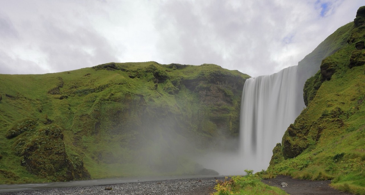
History and culture
Þingvellir links the Alþingi’s foundation in 930 with a tectonic rift valley. Haukadalur gave geysers their name; Gullfoss has been protected since 1979. The South Coast shows volcanism, glacial waters and marine erosion.
Natural sites adjoin farms and small settlements. Trail access does not permit entering private land; regional produce can be seasonal and the trip requires several separate drives.
Keep to marked paths, do not damage moss or collect stones in protected areas. Respect services in churches and privacy around homes. Check permissions for drones and individual artworks; public access does not automatically permit commercial use.
Places
Almannagjá Gorge
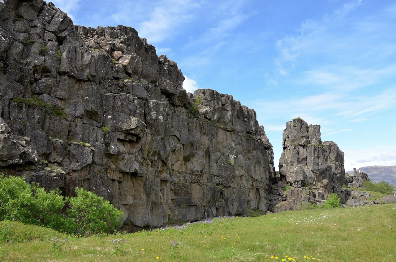
Rift gorge on the western edge of historic Þingvellir.
The gorge marks the North American plate’s edge; the opposite rift-valley boundary lies further east, not just across the path.
Shows tectonics beside the ancient assembly site.
Use the marked path from Hakið; expect a slope and possible ice. Parking is paid separately. Do not cross barriers for a “between the plates” photograph.
Lögberg — Law Rock
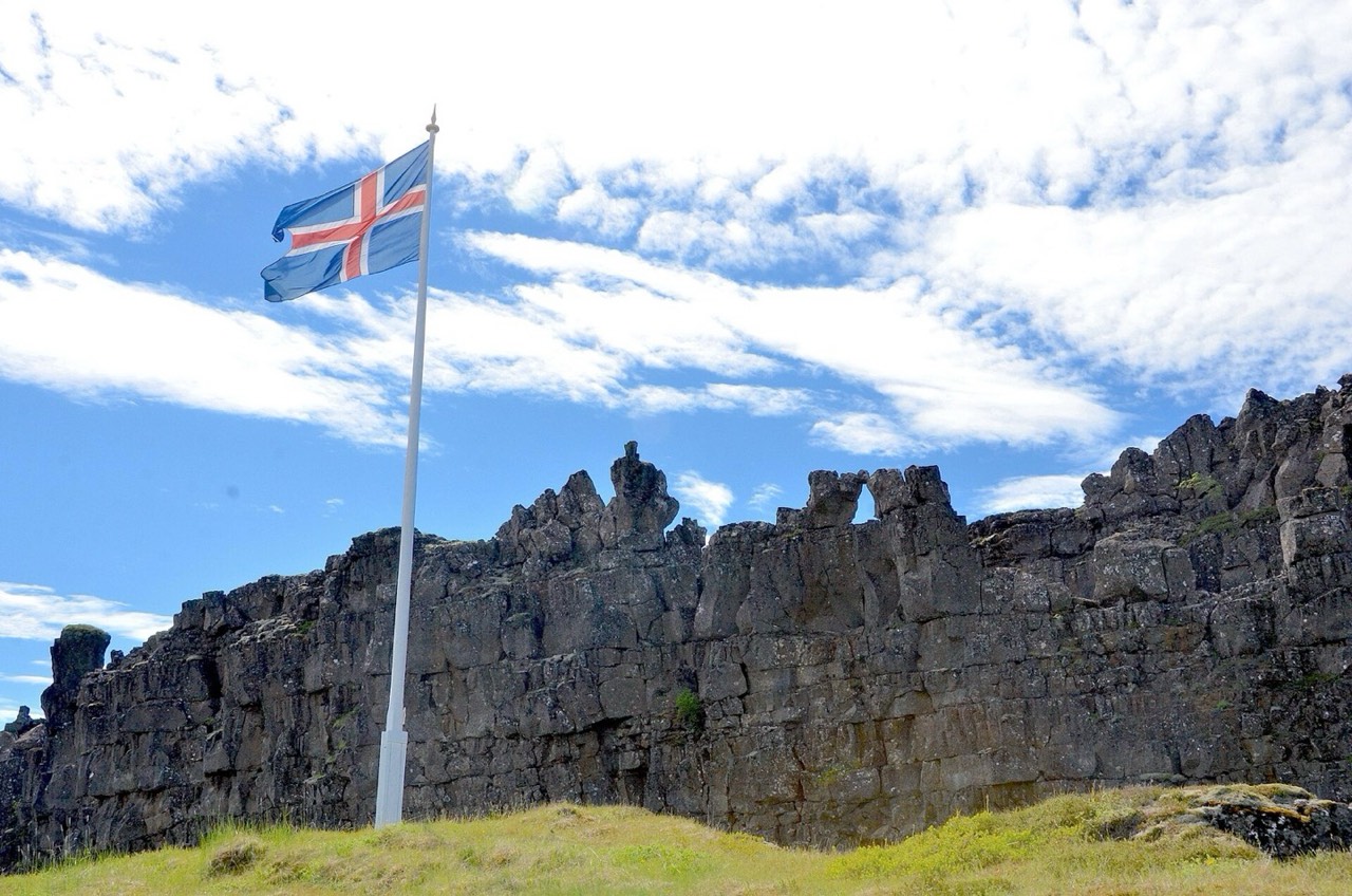
Marked location within the historic Alþingi assembly area.
The early Alþingi, founded in 930, was associated with public law recitation and open-air addresses. Lögberg forms part of a protected historic landscape.
Gives Þingvellir’s natural landscape its political significance.
Follow park signs; do not treat modern markers as a surviving tenth-century stage. Returning uphill to P1 requires effort and additional time.
Great Geysir
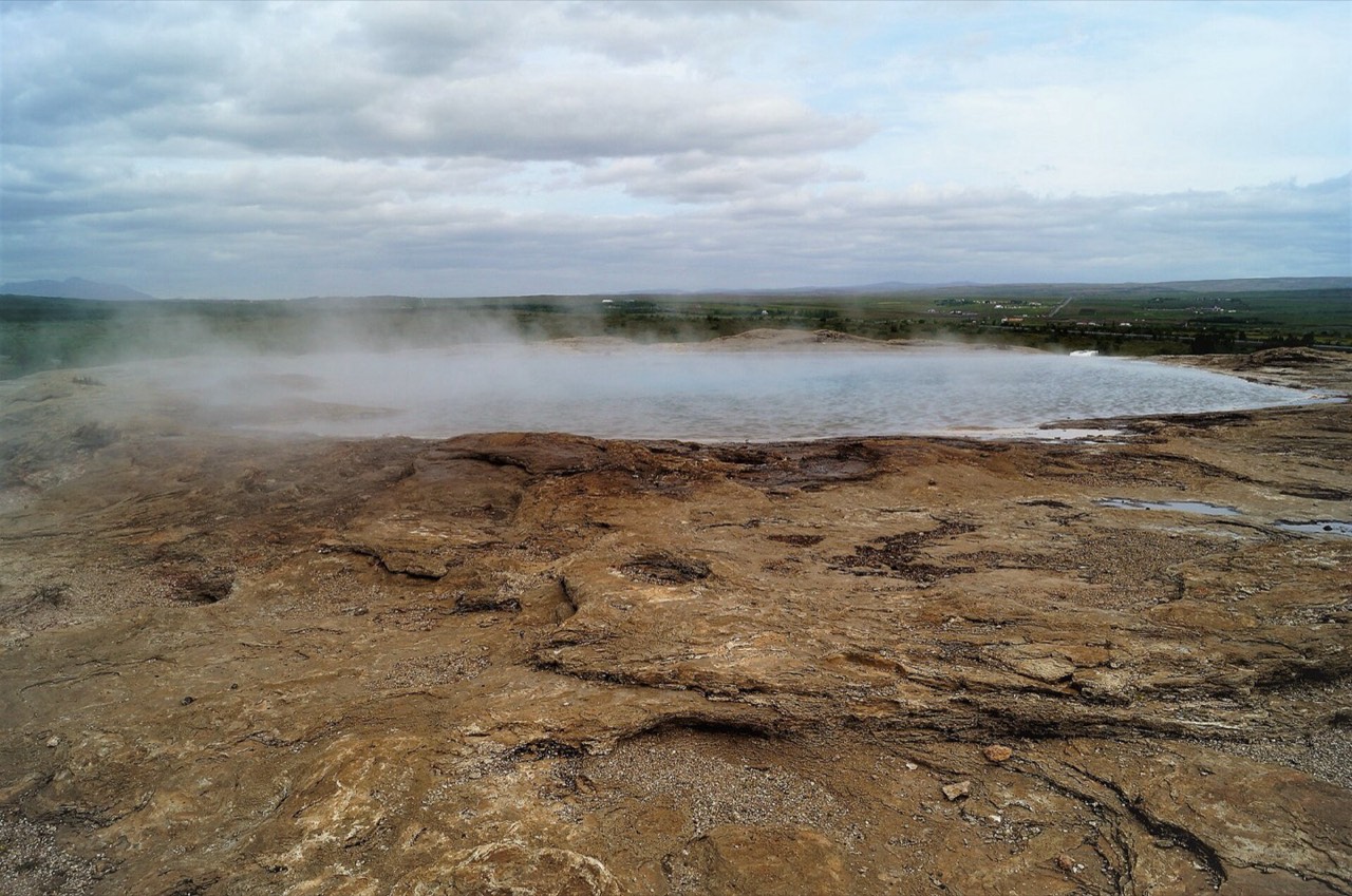
Historic hot spring that gave geysers their name.
Its activity has changed over time and after earthquakes. Geysir’s fame gave its name to the class of spouting hot springs.
Distinguishes historic Geysir from the more frequently erupting Strokkur.
Do not expect an eruption: this is not Strokkur. Hot water and steam are dangerous; stay behind barriers and do not test the temperature by hand.
Strokkur Geyser
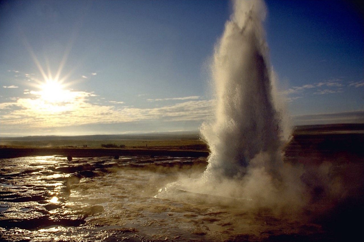
Frequently spouting hot spring in Haukadalur.
Strokkur is a separate spring in the geothermal field beside Great Geysir. Frequent water bursts make it the principal spectacle for present visitors.
Shows an active geothermal system without a promised timetable.
Stay on the designated side of barriers and consider wind carrying hot spray. Do not stand at the pool edge; intervals and heights are not guaranteed.
Gullfoss Waterfall
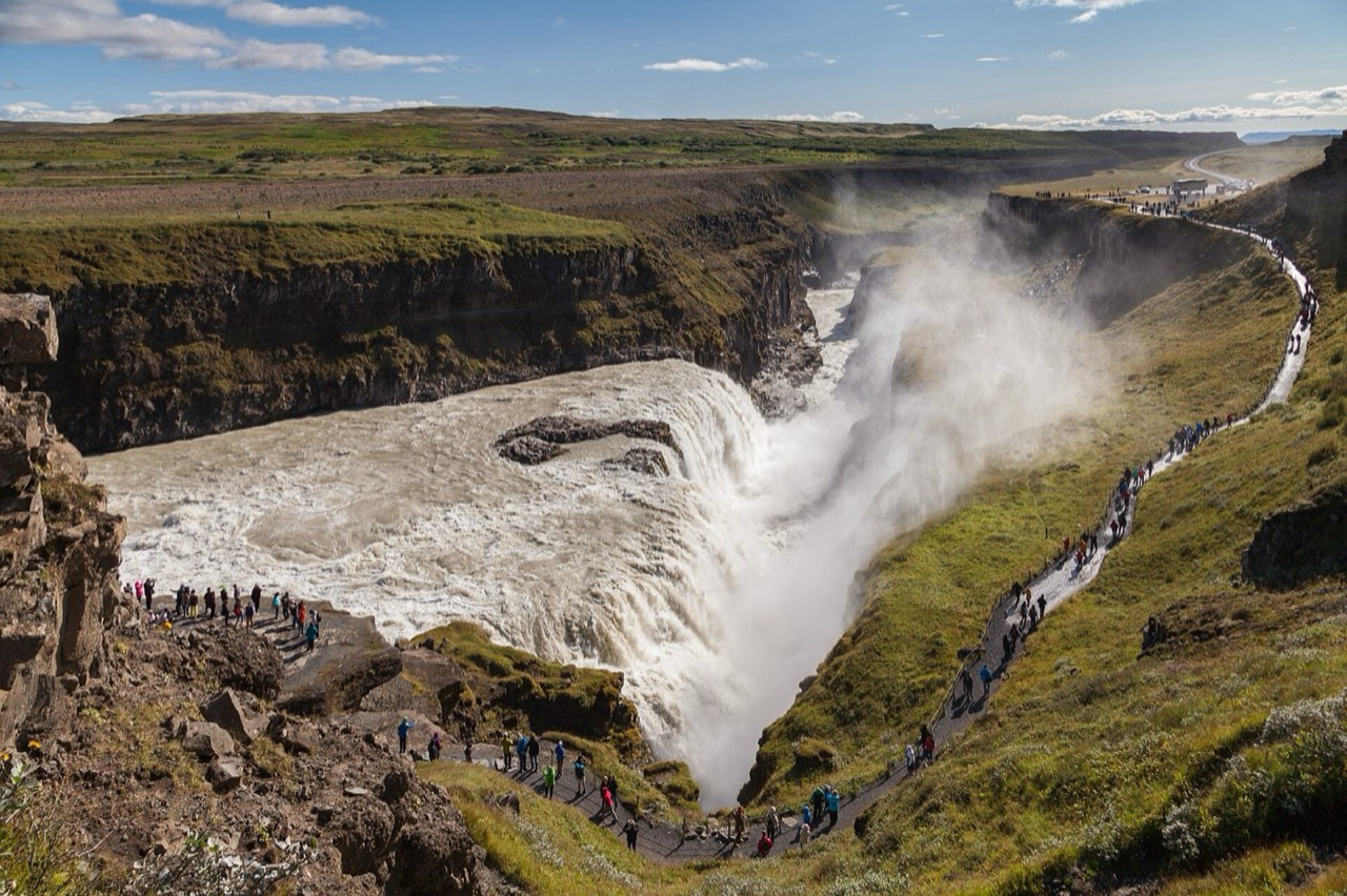
Permitted close approach to the Hvítá’s two-stage waterfall.
The waterfall and canyon have been protected since 1979. Water crosses two steps and enters a gorge carved through layered rock.
Offers a close view of the water’s force when the trail is open.
Check lower-trail access on SafeTravel and on site. Spray, slopes and ice create hazards; if closed, stay at permitted upper viewpoints and do not bypass barriers.
Gullfoss — upper panorama
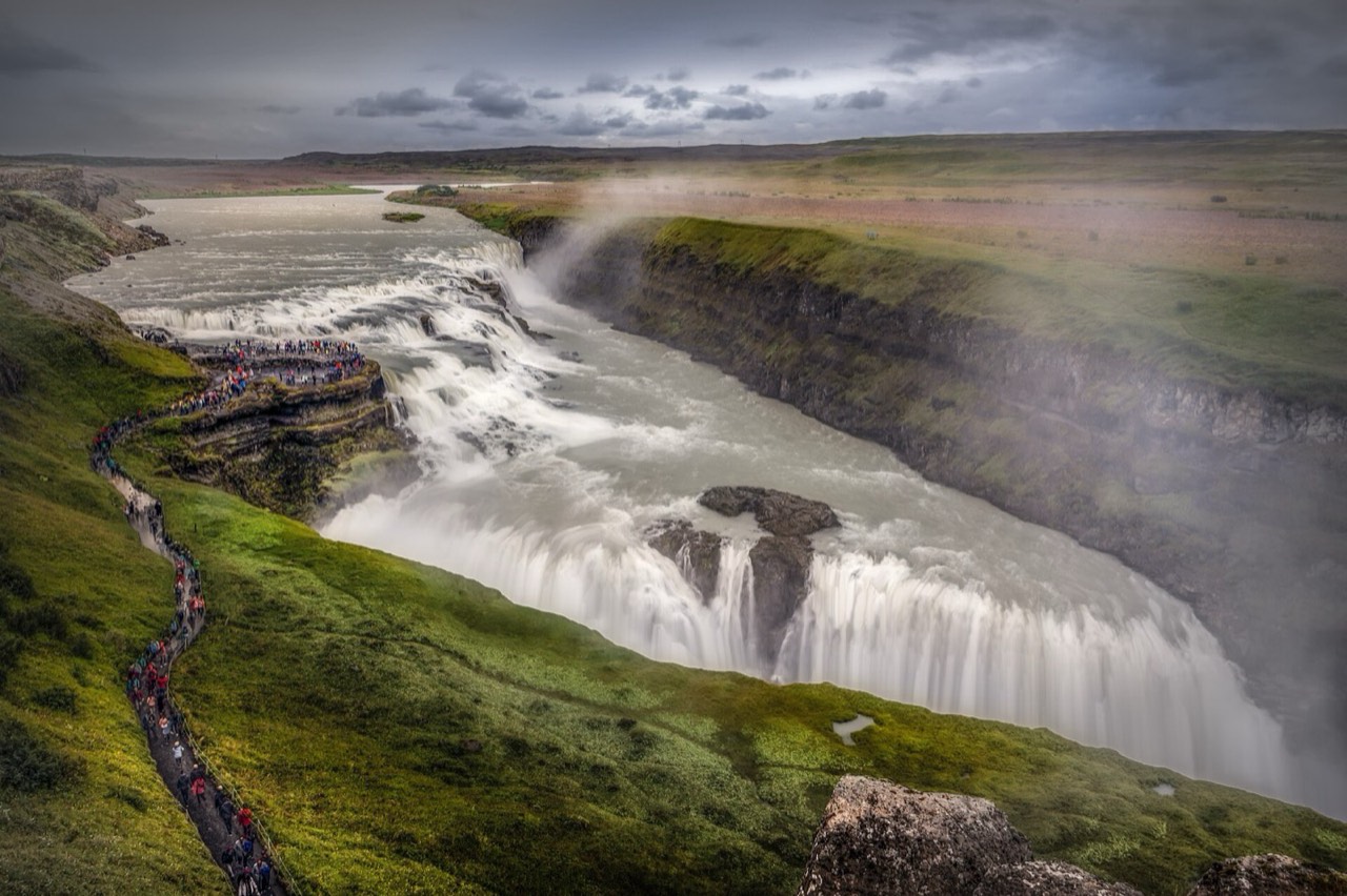
Upper perspective on the same waterfall and canyon bend.
This is a separate viewpoint of the same Gullfoss, not another waterfall. The panorama shows the Hvítá’s two drops in relation to the canyon.
Explains the waterfall’s shape and permits a shorter visit where access is allowed.
Follow signs to the upper viewing area near the café. Its access also depends on conditions; do not assume a fully step-free route. The lower approach adds slope and time.
Seljalandsfoss
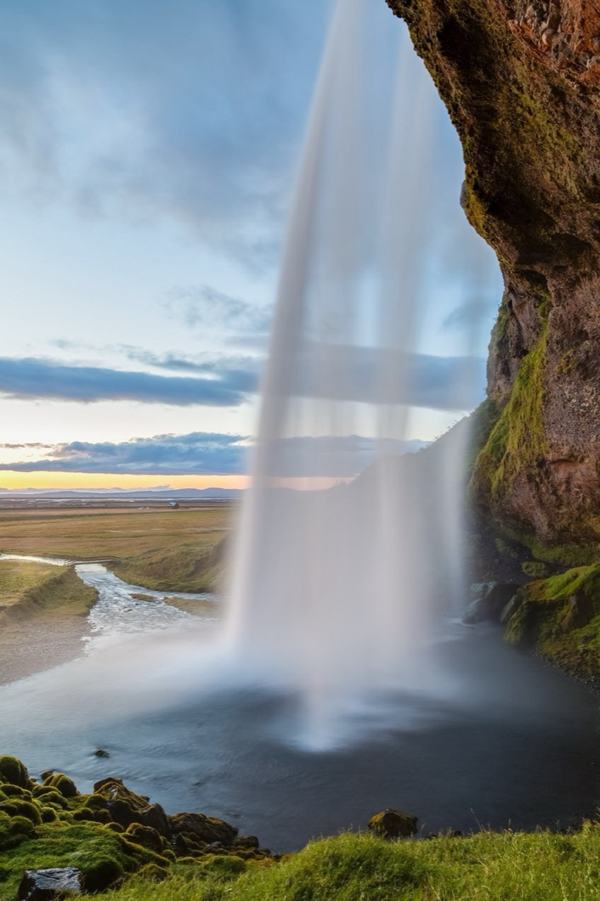
Waterfall beside the southern coastal plain with a path behind the water.
The Seljalandsá drops over a scarp beside Seljaland and Hamragarðar farms. At the cliff’s foot a path passes behind the curtain of water.
Shows water shaping the coastal landscape.
The path behind the falls is wet and can close for ice and falling ice blocks. It is not a mandatory walk: use the permitted front view when restricted. Allow for parking charges and waterproof clothing.
Skógafoss
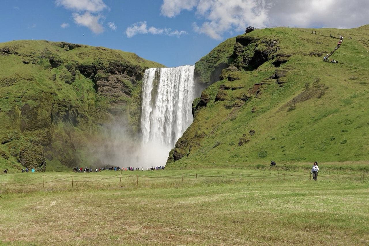
Large Skógá waterfall with a separate staircase to an upper view.
Water falls from a high South Coast scarp; persistent spray creates a rainbow only in suitable sunlight.
Shows the scale of southern Iceland’s water and relief.
Use permitted approaches and do not enter the river for photos. The steep stair climb is a separate effort, not part of viewing from below. Keep behind upper barriers; weather can affect access.
Reynisfjara — permitted viewpoint only
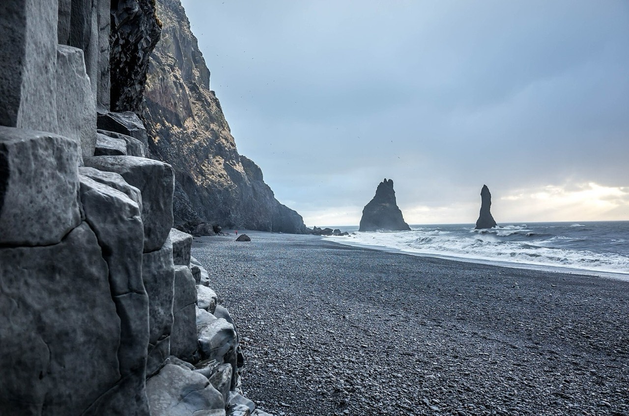
Black volcanic coastline with dangerous waves and a changing shoreline.
Volcanic rock, marine erosion and heavy surf formed the black sand and coastal cliffs. The shore is unstable and access can change after storms.
Shows a dynamic coast without treating a dangerous beach as a bathing route.
On the 3 October 2026 check, SafeTravel allows access only from the viewpoint. The pin marks the approach area, not a guaranteed permitted path: follow current signs. Do not descend to the beach, approach rockfall-prone columns or the water. Check updates and follow staff and police instructions.
Walking routes
Þingvellir: gorge and laws
Local walk: from the permitted Almannagjá path below Hakið towards marked Lögberg and accessible assembly-site paths. The distance includes local exploration, not the uphill return to parking. Shorten the visit for ice or closures; the drive to Geysir is separate.
1 km · 60 min
- Almannagjá Gorge · 20 min at stop
- Lögberg — Law Rock · 20 min at stop
Haukadalur: two different geysers
From the permitted side of Great Geysir follow the marked local path to Strokkur. Distance includes movement between available views; never cross thermal ground or barriers. An eruption is not guaranteed. Returning to the car and driving to Gullfoss are excluded.
0.5 km · 45 min
- Great Geysir · 15 min at stop
- Strokkur Geyser · 20 min at stop
Gullfoss: upper and lower views
Only when both sections are open: from the upper panorama use the signed trail and stair approaches to the permitted lower view. This visits one waterfall, not separate road destinations. If the lower trail is closed, visit only the open upper area: distance is shorter and the full route is not completed. Add the uphill return and drive towards the South Coast separately.
0.8 km · 60 min
- Gullfoss — upper panorama · 20 min at stop
- Gullfoss Waterfall · 20 min at stop
Food
Kjötsúpa — lamb soup
Icelandic lamb and vegetable soup found in regional cafés and restaurants.
National, not uniquely southern. Recipes and availability vary; check stock and allergenic additions.
Fish of the day
Fish prepared from the kitchen’s current offering; species and preparation depend on catch and supplier.
Ask the species, origin and price before ordering. Local catch is not guaranteed at every venue; check fish and sauce allergens.
Skyr with berries
Thick cultured dairy served with berries or cream.
Check dairy and toppings separately; wild berries and local origin are not guaranteed year-round.
Harðfiskur — dried fish
Traditional dried-fish snack sold in varied forms.
Check fish species and storage on the label. Not vegetarian; butter adds a dairy allergen.
Icelandic pancakes
Thin pancakes with jam or sugar, sometimes cream.
Availability depends on café and season. Check wheat, eggs and milk; not every roadside stop serves them.
Practical information
Sites require substantial road transfers, not walks. Plan a hire car or organised trips with time, daylight and forecast margins. Countryside Strætó does not use Klapp: it has separate fares and accepts cash and cards on board. It does not guarantee connections to every waterfall and trail. Check umferdin.is and SafeTravel before departure.
112 is for emergencies, backup +354 599 0112. Stay behind barriers at hot springs and cliffs; do not ford rivers or drive off-road. On the 3 October 2026 check, Reynisfjara is accessible only from the viewpoint: do not descend to the beach and check current restrictions. Waves, rockfalls, wind and ice can close individual paths.
Money and payments
Icelandic króna, ISK, not euro. Cards are widely accepted; carry a backup payment method and know your PIN. Car hire can require a credit card and deposit: check the contract rather than relying on a debit card alone.
Tipping
Tips are not expected; an optional amount can acknowledge exceptional service. Check the final bill and service terms; an additional percentage is not compulsory.
Transport
Sites require substantial road transfers, not walks. Plan a hire car or organised trips with time, daylight and forecast margins. Countryside Strætó does not use Klapp: it has separate fares and accepts cash and cards on board. It does not guarantee connections to every waterfall and trail. Check umferdin.is and SafeTravel before departure.
Emergency help
112 is for emergencies. If 112 will not connect, the official backup number is +354 599 0112; chat at 112.is also requires internet. State your location, coordinates and incident. Sources: Neyðarlínan and SafeTravel; coverage away from settlements is not guaranteed.
Electricity
European sockets with round contacts, 50 Hz. Check that the appliance is rated for 220–240 V and has a suitable plug, preserving required earthing. A normal plug adapter does not transform voltage.
Connectivity and offline use
2G/3G shutdown is underway in 2026: ask your operator about voice-call and 112 compatibility. Save maps, addresses and the backup number in advance; an offline map cannot restore phone coverage. Klappið ticket activation requires internet; keep your phone charged.
Verified sources and photo licences
- Visit Reykjavík: ISK, widely accepted cards and optional tipping · visitreykjavik.is
- Visit Reykjavík: round-pin European sockets and 50 Hz; check appliance voltage · visitreykjavik.is
- Reykjavík conference organiser: 220–240 V / 50 Hz compatibility · 2027.ieeeigarss.org
- Neyðarlínan: 112, backup +354 599 0112 and online chat · www.112.is
- SafeTravel: 2026 2G/3G shutdown and emergency-call compatibility · safetravel.is
- Strætó: local payment system and regional exclusions · www.straeto.is
- ICE-SAR SafeTravel: current weather, road and site warnings · safetravel.is
- Icelandic Road and Coastal Administration: live road conditions · umferdin.is
- SafeTravel: Reynisfjara currently accessible only from the viewpoint, checked 3 October 2026 · safetravel.is
- Þingvellir park: mapped local walking paths, Almannagjá and Lögberg · www.thingvellir.is
- Þingvellir park: paid parking, P1 Hakið and visitor centre · www.thingvellir.is
- Environment Agency: Gullfoss protected 1979, marked paths and drone restrictions · ust.is
- Business Iceland: national lamb soup, skyr, fish, dried fish and pancakes · www.visiticeland.com
- Visit South Iceland: Golden Circle and South Coast are separate touring routes · www.south.is
- Environment Agency: separate Geysir and Strokkur springs · www.ust.is
- Visit South Iceland: Seljalandsfoss wet rear path and Skógafoss steep staircase · www.south.is
- Almannagjá Gorge · www.thingvellir.is
- Lögberg — Law Rock · www.thingvellir.is
- Great Geysir · www.south.is
- Strokkur Geyser · www.south.is
- Gullfoss Waterfall · www.south.is
- Gullfoss — upper panorama · gullfoss.is
- Seljalandsfoss · www.south.is
- Skógafoss · www.south.is
- Reynisfjara — permitted viewpoint only · safetravel.is